This is a collection of photos of Earling, WV. You can help preserve a bit of Logan County history by sharing your vintage photos with us. To share a photo, please send it to the admin at loganwv.us@gmail.com. Please note that you must own the photo you are submitting or ensure that no one has a copyright claim on it.

November 1918, Troy Vance 18, grandson of Devil Anse Hatfield was killed in a mining accident on his first day at work. Courtesy of Bill Lamont. Image 1487.
November 1918, Troy Vance 18, grandson of Devil Anse Hatfield was killed in a mining accident on his first day at work. Courtesy of Bill Lamont. Image 1487.
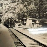
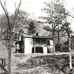
Courtesy of James F. Cremeans and his sister Glenna J. Cremeans. “ My sis said this pic was given to her many years ago by a close friend (Bud Janitch) who I think was from Taplin WV. The picture of house with steam engine was C&O house at Earling (Manbar) approx. 1950 where I lived from 1948 till 1961 when the house burned.” Image 61643.
Courtesy of James F. Cremeans and his sister Glenna J. Cremeans. “ My sis said this pic was given to her many years ago by a close friend (Bud Janitch) who I think was from Taplin WV. The picture of house with steam engine was C&O house at Earling (Manbar) approx. 1950 where I lived from 1948 till 1961 when the house burned.” Image 61643.
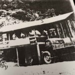
“Stinger” Toler´s Store at Manbar about 1950. Courtesy of James F. Cremeans and his sister Glenna J. Cremeans. “ My sis said this pic was given to her many years ago by a close friend (Bud Janitch) who I think was from Taplin WV.” Image 3124.
“Stinger” Toler´s Store at Manbar about 1950. Courtesy of James F. Cremeans and his sister Glenna J. Cremeans. “ My sis said this pic was given to her many years ago by a close friend (Bud Janitch) who I think was from Taplin WV.” Image 3124.
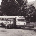
Earling, WV 1940s courtesy of Lisa Anderson Freeman. 18914
Earling, WV 1940s courtesy of Lisa Anderson Freeman. 18914
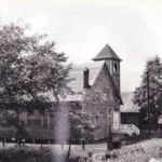
Earling Methodist Church courtesy of Lisa Anderson Freeman. 15694
Earling Methodist Church courtesy of Lisa Anderson Freeman. 15694
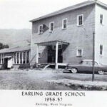
Earling Grade School 1956-57 courtesy of Arlene Esque Rounce. (466816)
Earling Grade School 1956-57 courtesy of Arlene Esque Rounce. (466816)
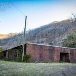
Earling Elementary School courtesy of Dylan Vidovich.
Earling Elementary School courtesy of Dylan Vidovich.

Earling Elementary School courtesy of Dylan Vidovich.
Earling Elementary School courtesy of Dylan Vidovich.
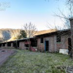
Earling Elementary School courtesy of Dylan Vidovich.
Earling Elementary School courtesy of Dylan Vidovich.
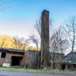
Earling Elementary School courtesy of Dylan Vidovich.
Earling Elementary School courtesy of Dylan Vidovich.
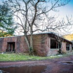
Earling Elementary School courtesy of Dylan Vidovich.
Earling Elementary School courtesy of Dylan Vidovich.

Earling Elementary School courtesy of Dylan Vidovich.
Earling Elementary School courtesy of Dylan Vidovich.
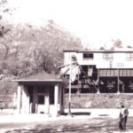
1945, Earling, WV courtesy of Arlene Esque Rounce. Image 78192.
1945, Earling, WV courtesy of Arlene Esque Rounce. Image 78192.
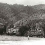
Baseball field at Earling, WV courtesy of John Paul Curry.
Baseball field at Earling, WV courtesy of John Paul Curry.
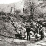
Men playing marbles or pitching coins at Earling courtesy of John Paul Curry.
Men playing marbles or pitching coins at Earling courtesy of John Paul Curry.
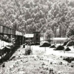
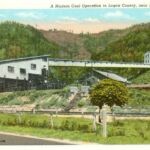
Earling tipple and school courtesy of John Paul Curry.
Earling tipple and school courtesy of John Paul Curry.
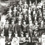
Day Shift, Earling, WV, Sept. 8, 1939 courtesy of John Paul Curry.
Day Shift, Earling, WV, Sept. 8, 1939 courtesy of John Paul Curry.
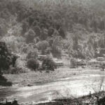
Building a bridge at Earling courtesy of John Paul Curry.
Building a bridge at Earling courtesy of John Paul Curry.
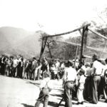
Playing baseball at Earling, WV courtesy of John Paul Curry.
Playing baseball at Earling, WV courtesy of John Paul Curry.
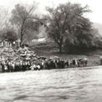
Babtizing at Earling, WV courtey of John Paul Curry.
Babtizing at Earling, WV courtey of John Paul Curry.

Mrs. Hutchinson, teacher (not shown). Donna Caldwell, Brenda Debta, Mary Blankenship, and Josephine Lamber. Photo courtesy of Jane Kelley. Please leave a comment to correct the any of the names.
Mrs. Hutchinson, teacher (not shown). Donna Caldwell, Brenda Debta, Mary Blankenship, and Josephine Lamber. Photo courtesy of Jane Kelley. Please leave a comment to correct the any of the names.

Mrs. Hutchinson, teacher (not shown). E Hager, Scott Maynard, Terry Robinett, John Cooper, Glen Sparilding, Billy Ruggles, Terry ?. Photo courtesy of Jane Kelley. Please leave a comment to correct the any of the names.
Mrs. Hutchinson, teacher (not shown). E Hager, Scott Maynard, Terry Robinett, John Cooper, Glen Sparilding, Billy Ruggles, Terry ?. Photo courtesy of Jane Kelley. Please leave a comment to correct the any of the names.
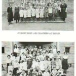
I also grew up in EARLING. My grandfather Kennie Browning worked there. I lived beside the grade school. We Boomers were bussed to the school near the church for 3-4 grades. We had to walk at first since it did not qualify for the c2 mile rule. Back then we girls had towers dresses and walk the 1.9 miles. But soon we were allowed tower pants and change at school. Luckily they decided to bus us after all.
Gwen Pelfrey
My grandmother ran the post office in Earling until 1977 when she retired. My grand father was a Forman in the mines.
Tim, what were their names?
I grew up in Earling from age 3 till age 16 (1948- 1962). We lived in C&O house lower end of Earling (Manbar) .
I grew up there from 1948 – 1962, we lived in C&O railroad house until it burned in Feb. of 1962.
Who owned the mines back in the early fifties ? My mom and dad met there and later married .
The photo that shows the building of the bridge is actually Wilburn across the river and Rita to the right. There was a coal mine on Rita and they took the coal across the river to Wilburn tipple. Wilburn is where the mall was build after they tore down Wilburn to make space for it.
Arlene,
It appears that the bridge being built in the photo is the railroad bridge at Rita. I don’t know when the railroad bridge was built but it was not shown on the 1928 USGS topography map.
I have reviewed a map titled: “Logan Eagle Coal Co.- Rita W. Va.- Map Showing Property And Mine Workings In Island Creek Seam, Mine No. 3” The map shows two mines across the river which were very close together with their openings at about the 1035-foot elevation line up on the hill. These mines are labelled on the map as No. 1 Mine and No.2 Mine.
No. 2 Mine mined downriver a short distance. No. 1 Mine mined up the right side of Rich Creek for about a mile, crossing under the headwaters of Bob Hollow and Birch Crossing Hollow. When it got to the Right Fork of Rich Creek it made an opening on the right side of Right Fork. It appears that it crossed over that fork of Rich Creek and made an opening on the left side of the Right Fork and continued up Rich Creek for a moderate amount of mining in that area. That area was not named on the map but I suspect that was the “Mine No. 3” listed in the map title.
It is my understanding that the coal was transported across the river to the railroad tipple by an aerial tram bucket line system. The tipple was located in the curve area just above where Walker Machinery’s facilities are.
The map appears to show some sort of structure crossing the river downstream of the mouth of Rich Creek and the tipple. The map is unclear as to what that structure is was. It could be that it indicates where a low water ford crossing was or perhaps it was a walkway suspension bridge. The railroad bridge is upriver of the mouth of Rich Creek.
It appears that the Logan Eagle Coal Co. property area was about 650-acres in size and was bordered by properties of McDonald Land Company and Main Island Creek Coal Company. I think it is likely the property was owned by the Hinchman Heirs. Arlene,
It appears that the bridge being built in the photo is the railroad bridge at Rita. I don’t know when the railroad bridge was built but it was not shown on the 1928 USGS topography map.
I have reviewed a map titled: “Logan Eagle Coal Co.- Rita W. Va.- Map Showing Property And Mine Workings In Island Creek Seam, Mine No. 3” The map shows two mines across the river which were very close together with their openings at about the 1035-foot elevation line up on the hill. These mines are labelled on the map as No. 1 Mine and No.2 Mine.
No. 2 Mine mined downriver a short distance. No. 1 Mine mined up the right side of Rich Creek for about a mile, crossing under the headwaters of Bob Hollow and Birch Crossing Hollow. When it got to the Right Fork of Rich Creek it made an opening on the right side of Right Fork. It appears that it crossed over that fork of Rich Creek and made an opening on the left side of the Right Fork and continued up Rich Creek for a moderate amount of mining in that area. That area was not named on the map but I suspect that was the “Mine No. 3” listed in the map title.
It is my understanding that the coal was transported across the river to the railroad tipple by an aerial tram bucket line system. The tipple was located in the curve area just above where Walker Machinery’s facilities are.
The map appears to show some sort of structure crossing the river downstream of the mouth of Rich Creek and the tipple. The map is unclear as to what that structure is was. It could be that it indicates where a low water ford crossing was or perhaps it was a walkway suspension bridge. The railroad bridge is upriver of the mouth of Rich Creek.
It appears that the Logan Eagle Coal Co. property area was about 650-acres in size and was bordered by properties of McDonald Land Company and Main Island Creek Coal Company. I think it is likely the property was owned by the Hinchman Heirs.
Arlene,
It appears that the bridge being built in the photo is the railroad bridge at Rita. I don’t know when the railroad bridge was built but it was not shown on the 1928 USGS topography map.
I have reviewed a map titled: “Logan Eagle Coal Co.- Rita W. Va.- Map Showing Property And Mine Workings In Island Creek Seam, Mine No. 3” The map shows two mines across the river which were very close together with their openings at about the 1035-foot elevation line up on the hill. These mines are labelled on the map as No. 1 Mine and No.2 Mine.
No. 2 Mine mined downriver a short distance. No. 1 Mine mined up the right side of Rich Creek for about a mile, crossing under the headwaters of Bob Hollow and Birch Crossing Hollow. When it got to the Right Fork of Rich Creek it made an opening on the right side of Right Fork. It appears that it crossed over that fork of Rich Creek and made an opening on the left side of the Right Fork and continued up Rich Creek for a moderate amount of mining in that area. That area was not named on the map but I suspect that was the “Mine No. 3” listed in the map title.
It is my understanding that the coal was transported across the river to the railroad tipple by an aerial tram bucket line system. The tipple was located in the curve area just above where Walker Machinery’s facilities are.
The map appears to show some sort of structure crossing the river downstream of the mouth of Rich Creek and the tipple. The map is unclear as to what that structure is was. It could be that it indicates where a low water ford crossing was or perhaps it was a walkway suspension bridge. The railroad bridge is upriver of the mouth of Rich Creek.
It appears that the Logan Eagle Coal Co. property area was about 650-acres in size and was bordered by properties of McDonald Land Company and Main Island Creek Coal Company. I think it is likely the property was owned by the Hinchman Heirs.
Thank you for that clarifying information. I appreciate learning about our heritage.
I lived in the house directly in front of the gas station and company store 1964-1967
The store was owned by my Grandfather, Paul Black. He purchased the store after the Buffalo Creek Flood. He ran the storeup to the late 80’s before closing the doors for good.
Hi, Mrs Adkins. By any chance would you have a picture of the store when Mr. Black had it. I have been looking for years for a picture of it because it was a special place for me and my late husband Phillip Collins. Many memories of that store and Mr. Black, Gertie and Mona.
Thanks for sharing the photos. They bring back a lot of memories from when I grew up there in the 1950s.