JB Ellis Memories
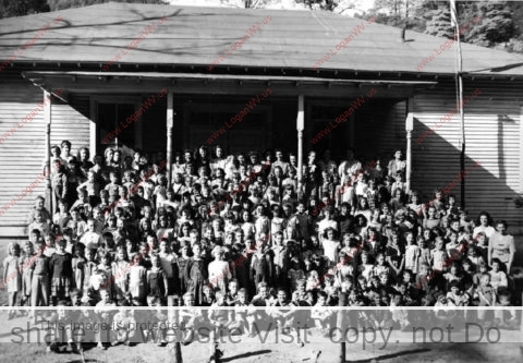
JB Ellis . . . the name stirs up all kinds of memories for me. My mother, Virginia McCormack, taught first and second grades there for many years. Looking back, I think her tenure at JB Ellis was the happiest of her long teaching career in Logan County Schools. The teachers were all friends and the school enjoyed an active and supportive PTA. Although Cherry Tree Grade School was my community school, mother took me with her to attend first grade. I suppose she wasn’t ready to cut me loose on my own. It was a memorable year, to say the least. Being the teachers’ kid did not cut me any slack. In fact, I found my backside meeting her paddle several times during that first year of school. She showed me no favoritism in the least. In fact being the teachers’ kid was to my disadvantage. Others were quick to tattle if I misbehaved on the play ground. I recall that I once kicked down the rock walls some of the girls had constructed for they playhouse. You guessed it, they told Mrs. McCormack. There were fun times with my best buddy, Bobby Gene Ellis — times of spending the night at his house and also going home with Bubby (Noel) Richardson for a while when Mother attended school meetings. After first grade I would return to JB Ellis for the annual school picnic. It was fun to reunite with former classmates and, of course, to miss a day of school at Cherry Tree.
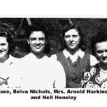
I recall the warmth of the pot bellied coal stoves, the smell of oiled floors, pencil sharpener shavings, the principal with hand bell signaling the end of recess.. The annual school carnival at the 16 Company Store Y were fun times for me. Mother always took care of the gold fish bowel. The school carnival was my first experience of eating sour kraut on hot dogs. Oh how I wanted to be the winner of the cake walk! I always envied that group of 5th & 6th graders that made up the JB Ellis chorus. The principal, Belva Nicholas, directed and my mother played the piano They were a group of gifted singers and I recall their rendition of songs like: “Cruzin Down the River,” and “Mocking Bird Hill.” With my interest in music, I longed to be a part of the scene. My mother would teach music for some of the other teachers and they would instruct her students in art.
I don’t know how many years the tradition of handing out silver dollars to students with perfect attendance was practiced. However, I do recall my mother polishing silver dollars at home in preparation for the awards to her students with perfect attendance. It made me wish I was attending JB Ellis and could qualify for this award for perfect attendance.
Bob Ellis (Bobby Gene) recalls the “Lukie Currys’” small improvised restaurant provided a pool table and offered a menu providing a kettle of soup made by Mrs. Curry; a hot dog, soup, drink and candy bar or 2 hot dogs, pop and candy bar for fifty cents. It was fun crossing the little bridge to access Lukie Curry’s.
I welcome contributions of any others who experienced JB Ellis School life.
Robert McCormack
J. B. Ellis Picture Gallery

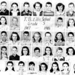
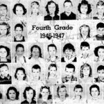
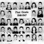
You may also enjoy the Mud Fork Gallery.
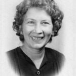

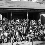



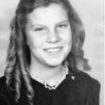
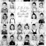
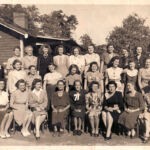
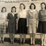
My Mom was part of the 5th Grade class 1947-1948 and part of the 4th grade class 1946-1947. I had no clue there was a J.B. Ellis School and a Curry School. My Mom passed away in 2016 so what a blessing to find her class pictures. I never knew much about her school days. Thank you for posting these pictures and very interesting information. Is there anyway to get a copy of a couple of the pictures posted? I would love to have the two that my Mom is in? Thank you again for this website. I stumbled upon it by accident and now I am hooked at reading all the memories. It’s great!
My grandparents lived on what we called the Verdunville straight stretch…we were allowed to walk down the alley and cross the road into Ellis Hollar (Hollow)…and we would play up on the Ellis Cemetery….at the time I didn’t know it was the Ellis Cemetery….since I have started doing family research…I found out that it is called the Ellis Cemetery….However, when they put the new 4 lane road in….they moved the graves and the road took that area….you would need to contact the local cemeteries in the area to see where all the graves were moved to….or at least that is what I have been told by other researchers…..played on that cemetery back in the late 80’s.
Rebecca,
The Department of Highway design drawings for the Corridor G Logan Connector road has a listing of graves (known and unknown names) that were displaced by the road. The listing includes the cemeteries where the graves were relocated to. (My grandmother’s grave was displaced from Ellis Cemetery by the road.)
Good luck!
P.S. Ellis Hollow was originally called Cincinnatus Branch. It is shown that way on early (1910-1912) U.S. Geological maps.
Doug, thanks for the info.
According to the D.R.’s posted
on the findagrave site they all
say the cemetery is there,where
is the question.Given the coal mining
in the area, the graves might have been
moved to another location or nature
has taken over with brush as is the
case in many cemeteries in Logan County.
My father attended J. B. Ellis school, but I’ve had some difficulty pinpointing exactly where it was in Verdunville. Can anyone tell me the precise location?
I’ve been away from Logan County for many years. If you can locate where the company store was on the left, you turn right and cross the RR and enter the alley splitting the row of houses. At the end of the alley turn left and pass a few houses before getting to the school site on the right. I’m sure the new road has changed the topography some since those days when the school stood there but you will see the new road up above high on the hill. My Mother taught there and I went to school for first grade. She was my teacher.
Robert,
Thanks for the reply. I’m still having a bit of trouble translating the description with the current layout of Verdunville. Here’s a Google Maps link showing the area.
https://www.google.com/maps/place/United+States+Postal+Service/@37.8472385,-82.0487937,284m/data=!3m1!1e3!4m5!3m4!1s0x884f7a8eeed9a855:0xc228c219fbf3f285!8m2!3d37.8469371!4d-82.047988
Could you maybe help me pinpoint it further based on the map? I’m assuming the larger rectangular building to the west (left) of the Post Office is where the old company store was.
Thanks for your help!
Mark
Mark, The Google site you posted is the area of #16 company store at Verdunville where the Verdunville School is. This area is a mile or so on up the road from the #15 company store where J.B. Ellis School was nearby.
The Google site you want to look at is this:
https://www.google.com/maps/place/J+B+Ellis+Hollow+Rd,+Mt+Gay-Shamrock,+WV+25601/@37.8491407,-82.0380401,17z/data=!3m1!4b1!4m5!3m4!1s0x884f7076d7d85321:0x9c923b28632ad784!8m2!3d37.8491407!4d-82.0358514
Or, you can type in the address of J B Ellis Hollow RD Logan WV, and it will picture the site. The school was at the end of Breezewood Ave on the Google map.
Doug, great map.
Do you have one that shows
the location of Stirrat
Community Church &
Cemetery?
Also Cora Cemetery in
Cora?
Bob,
Google is the service I use that gives mapping and “satellite” (aerial photo) views. I typed in “Stirrat Community Church” on their search menu and it showed mapping and a good aerial view of it but no cemetery that I could identify.
I note that the Stirrat Community Church is surrounded by extensive mining facilities which operate under permits and detailed maps filed with state and federal mining agencies. As I recall, there is a mine law restricting mining activities in close proximities to cemeteries. A review of the maps and drawings of the mining permits in the vicinity of the Stirrat Church may provide insight to the cemetery location.
If you type in: “cemetery near ______” in the Google map search menu, Google will show some cemeteries near that location, although they may not show all that are near there.
I believe (although I am not sure) that if you know where a cemetery is, you can go to it with a cell phone and get the latitude/longitude location data on the phone and you can use that latitude/longitude data to find that cemetery on a Google map.
There is a downloadable NASA mapping program on internet called “WORLDWIND” that MAY show more detail than Google but I think Google already uses the NASA aerial photo data. (I have not used the NASA stuff for several years so I don’t know how easy it is to use now.)
There is another internet mapping service called: “Microsoft Research Maps (MSR Maps) – formerly Terraserver”. (I have not used the Terraserver stuff for several years so I don’t know how easy it is to use now.)
FWIW: Certain agencies like agriculture, forestry, etc. do aerial photography that may be more recent than Google so you may look into that.
It may be possible that if the cell phone latitude/longitude data for many unmapped cemeteries could be collected by some recognized group (genealogical organizations, etc), the information could be furnished to Google and they could incorporate the cemeteries into their current mapping.
Good luck!
Mark,
The Google map area you posted is at #16 company store at Verdunville. This area is about a mile too far up Mud Fork.
Type in this address in your Google search:
“J B Ellis Hollow Rd, Logan WV” and you will see the area of where #15 company store was. J B Ellis School was at the end of the street called “Breezewood Ave” on the map. The site of the school appears to have a rusty topped trailer or metal roof building on it.
Douglas,
That’s just what I needed, and Robert’s directions make perfect sense with the map you sent, so thank you both.
my maiden name was Williamson my father Clyde Williamson was from Mud Fork but he would have graduated in the 30’s. could be related
I’m sorry to bother u need help my mom went to curry grade in 1945-1947 I between this she can’t find information no where need as much help as we can get her name was Joyce Spaulding her mother was hazl Williamson from mud fork hog pin alley it was called if u can us we thank u alot